
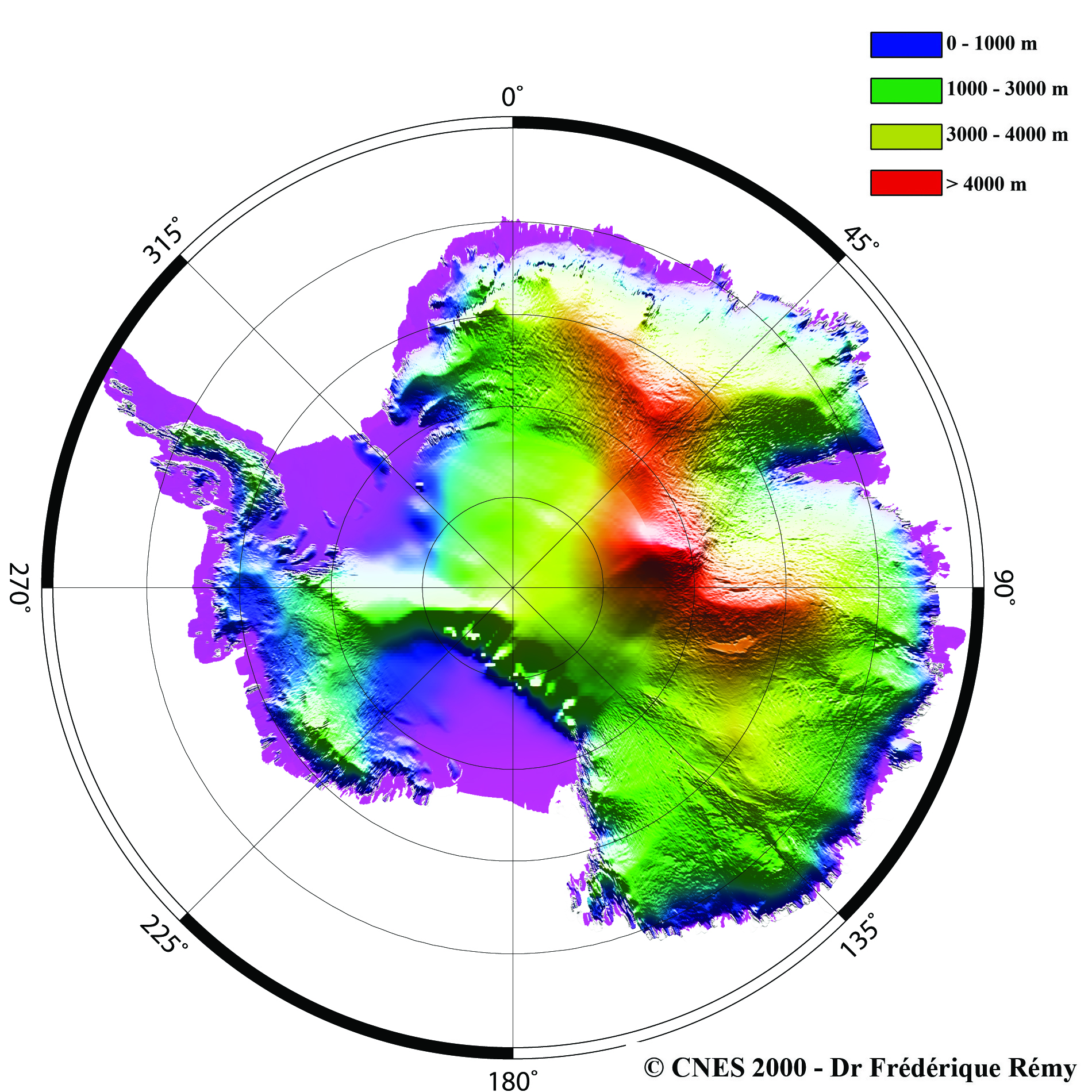
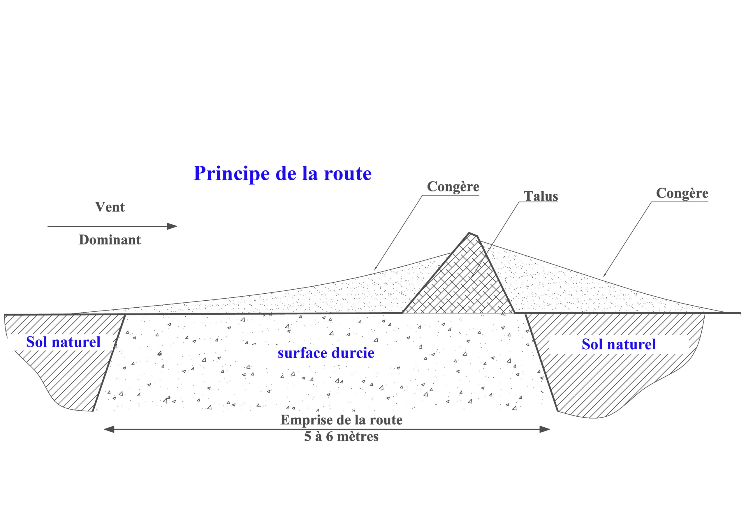
At the risk of stating the obvious, the continent is a featureless desert where navigation is an absolute necessity — a matter of knowing one’s position, but also of choosing it, as at sea. A ship follows the most direct route possible, avoiding zones identified in advance. The same applies here: convoys must follow a route linking two points while avoiding areas presenting difficulties. On the ice sheet, this means avoiding crevasse zones, steep gradients, surfaces unable to bear the load, and high sastrugi. Although the list of constraints is broader, precision was not initially a requirement. It became one once transport efficiency asserted itself. To improve net payload delivered, it is essential to travel on a hardened track. Tractors grip better, loads sink less. The track hardens through repeated passes under load, journey after journey, and successive grading operations provide acceptable geometric quality.
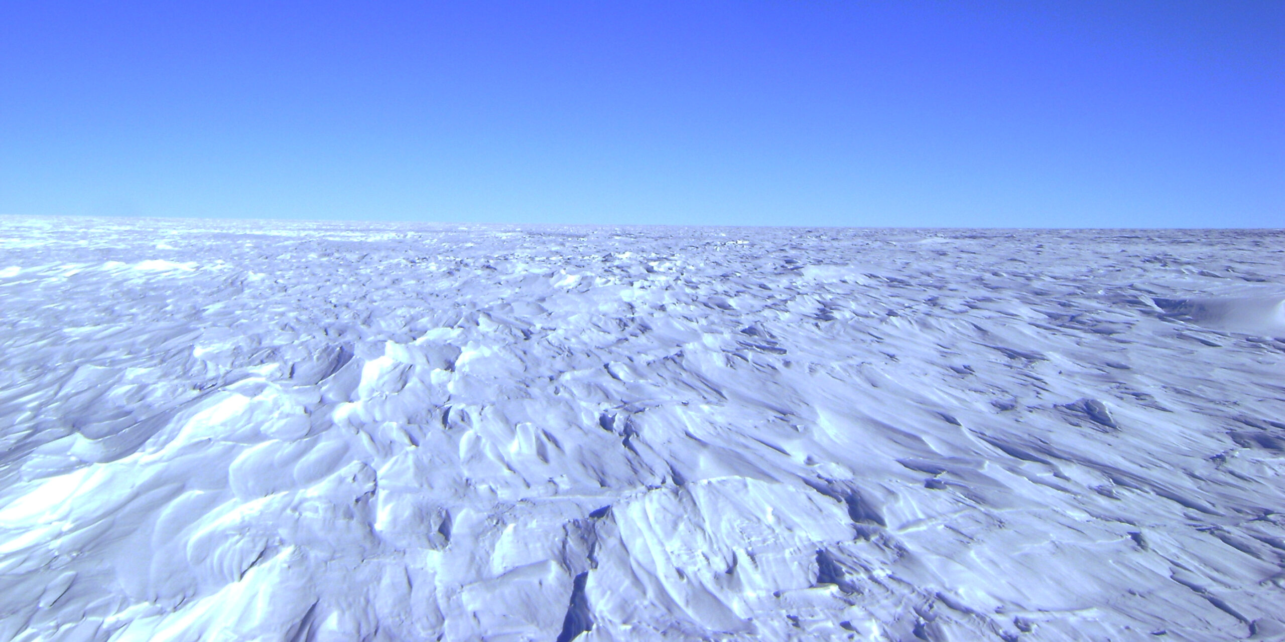
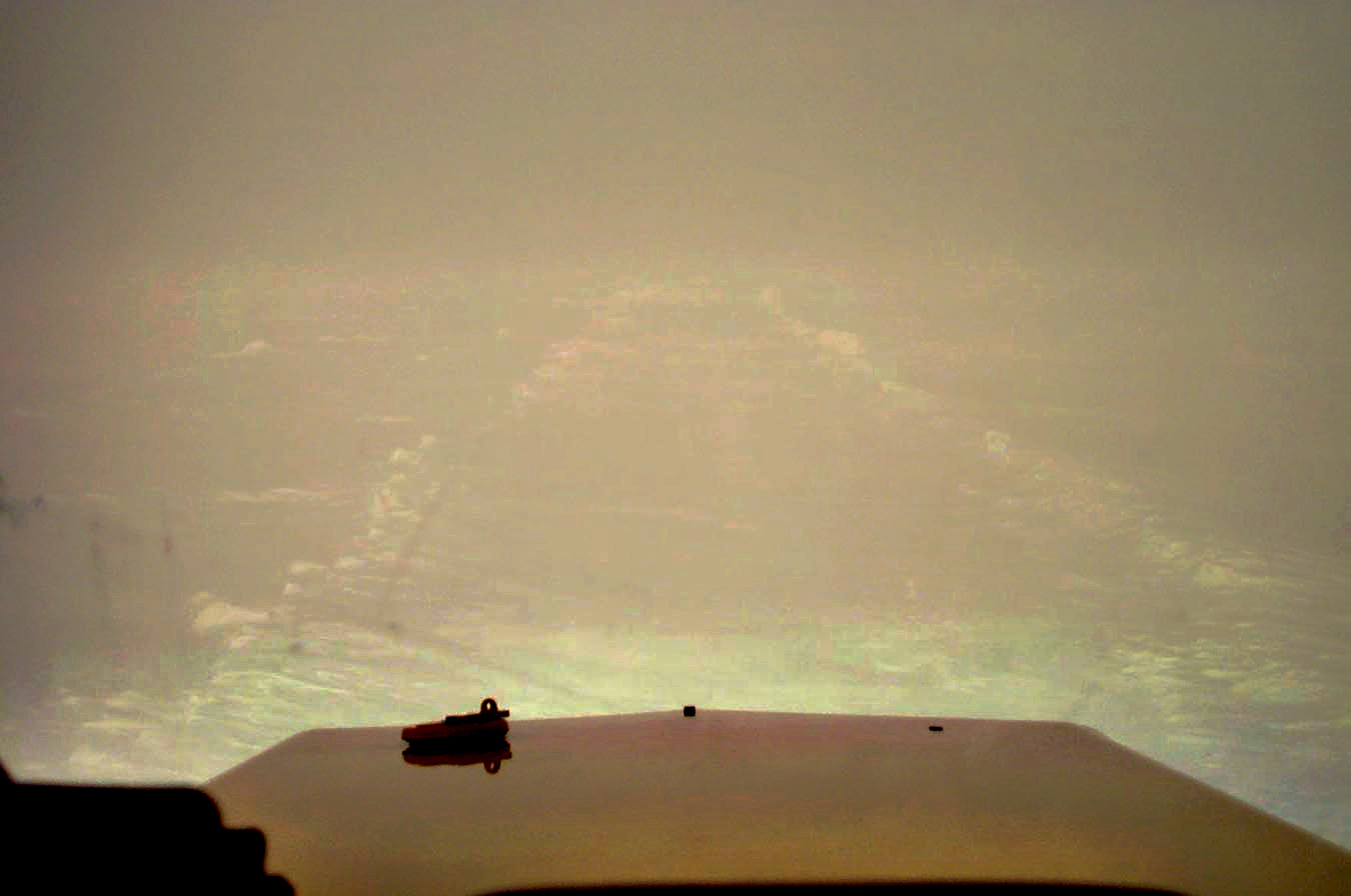
Travelling on the same track requires relocating it from one year to the next despite winter precipitation that covers it — fortunately light, a few centimetres per year — and from one journey to the next within the same season. Relocating it within the same season is generally not a problem, except in bad weather and especially in white-out conditions. White-out results from a cloud cover composed mainly of stratus: the uniformly white-grey sky merges with the ground, shadows disappear, and surface relief becomes invisible — despite sometimes very intense luminosity. Relocating an old track under white-out conditions then becomes a considerable challenge.
The first convoy organisers on the ice sheet maintained a network of stakes. Physical stakes or markers could go several years without being resurveyed, but it was time-consuming work. Each stake had to be firmly anchored, then its position surveyed by theodolite using stellar sightings, as in maritime navigation. This worked in the absence of anything better, but the slightest bad weather would halt the convoy, and precision was lacking.
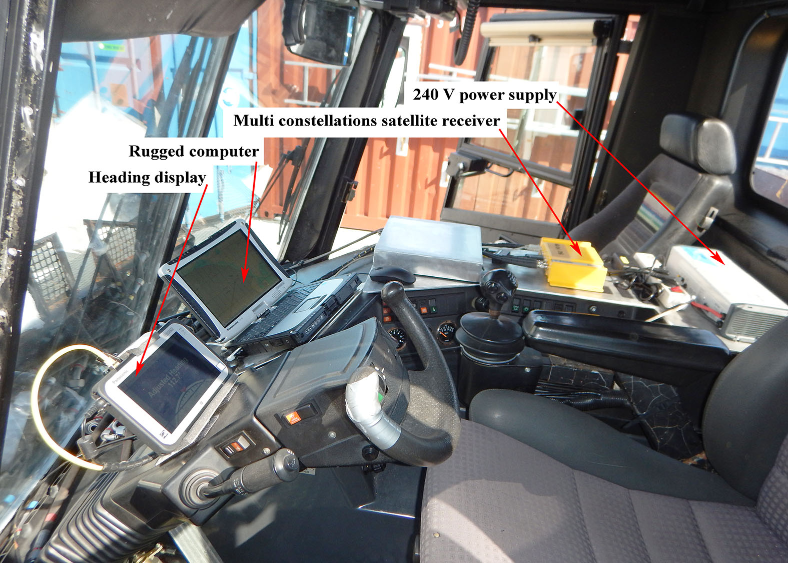
Then came a change of era. Electronics came to the rescue in late 1989: guidance electronics with GPS constellations and the first precision satellite imagery. Imagery helped identify zones to avoid; GPS enabled positioning and direction-setting. The Navstar GPS, a US Navy tool, was initially coded to limit its precision so that potential adversaries could not use it to guide hostile weapons. The coding was lifted in 1999 — almost certainly because the Russian Glonass constellation had by then come into its own. Accuracy for standard receivers then improved from 100 m to 20 m.
between two convoys
between two summer seasons
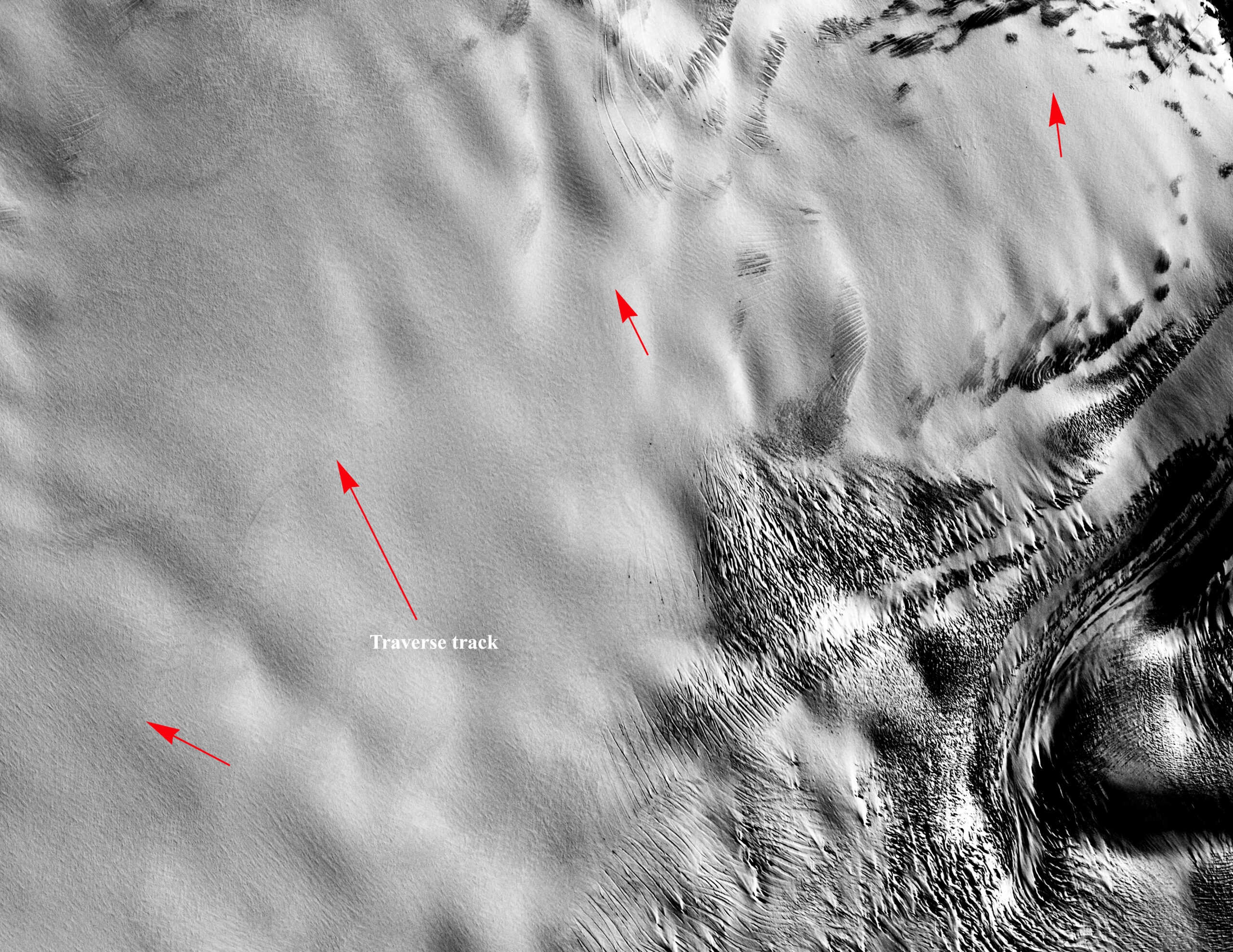
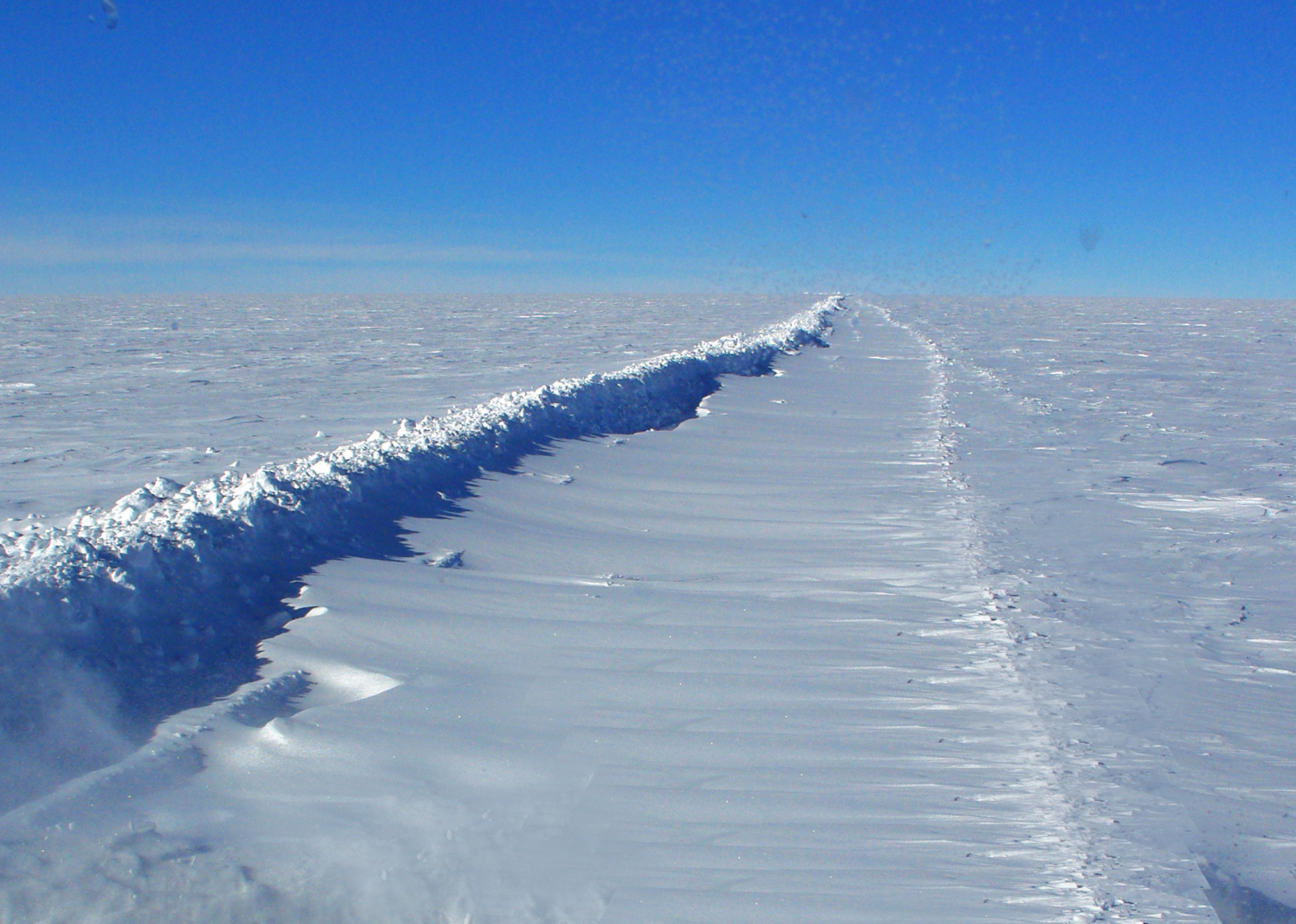
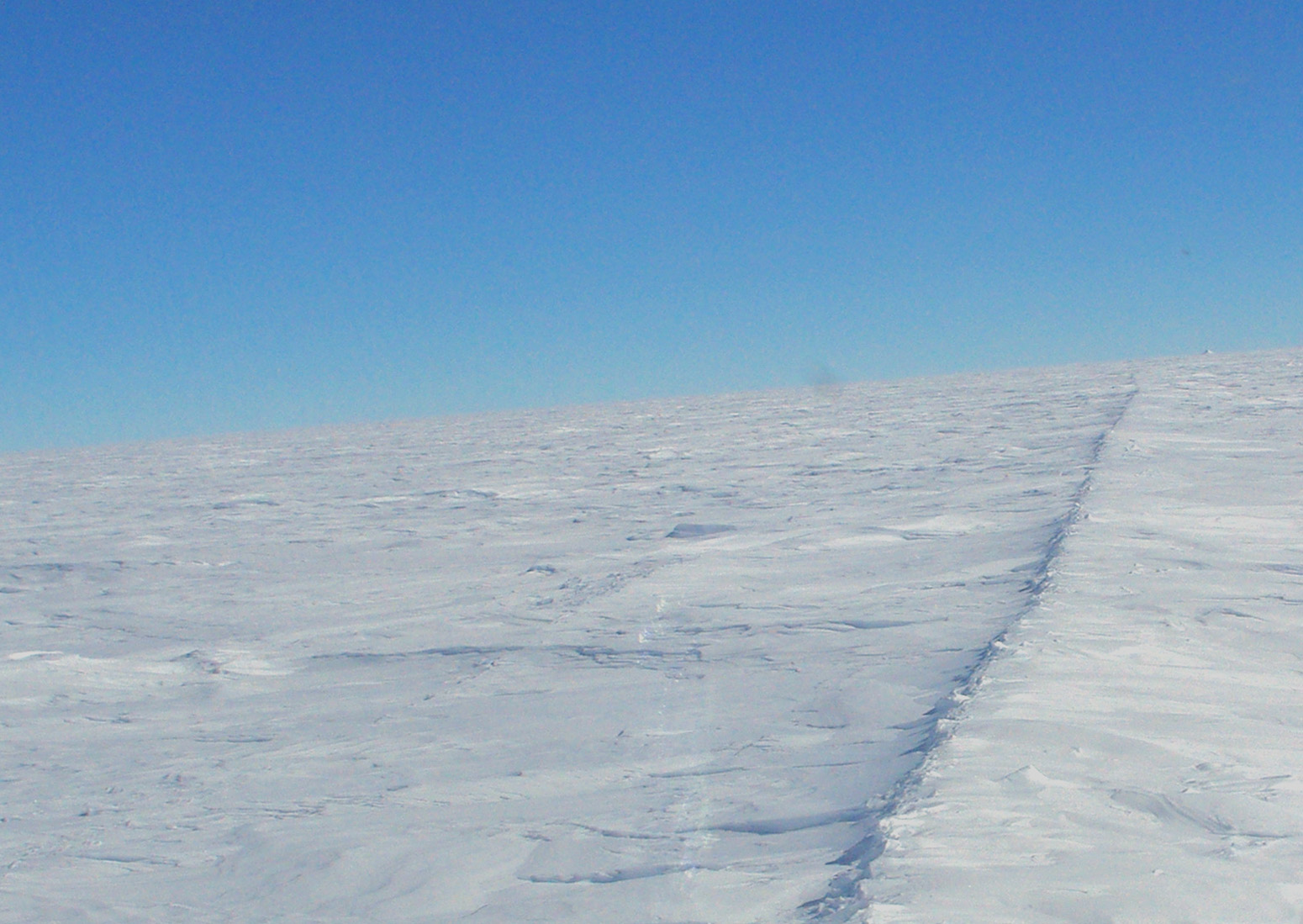
Twenty metres was nonetheless insufficient to relocate a track in bad weather. As early as 1996, the idea of recreating physical markers took hold. Physical marking using added elements — tubes, stakes, masts — combined with radar could have been a solution, but was ruled out due to insufficient precision, the large number of markers required, and maintenance constraints. Taking inspiration from a few tracks that remained naturally visible, grading machinery was used to construct a berm on the western side of the route, high enough not to be covered between seasons — around fifty centimetres. The berm thus remains visible from one season to the next. This solution works, but the berm must be consolidated on each pass. This work requires the grading machines to operate with an angled blade, and in low-wind areas the berm generates its own snowdrift.
used to locate the track
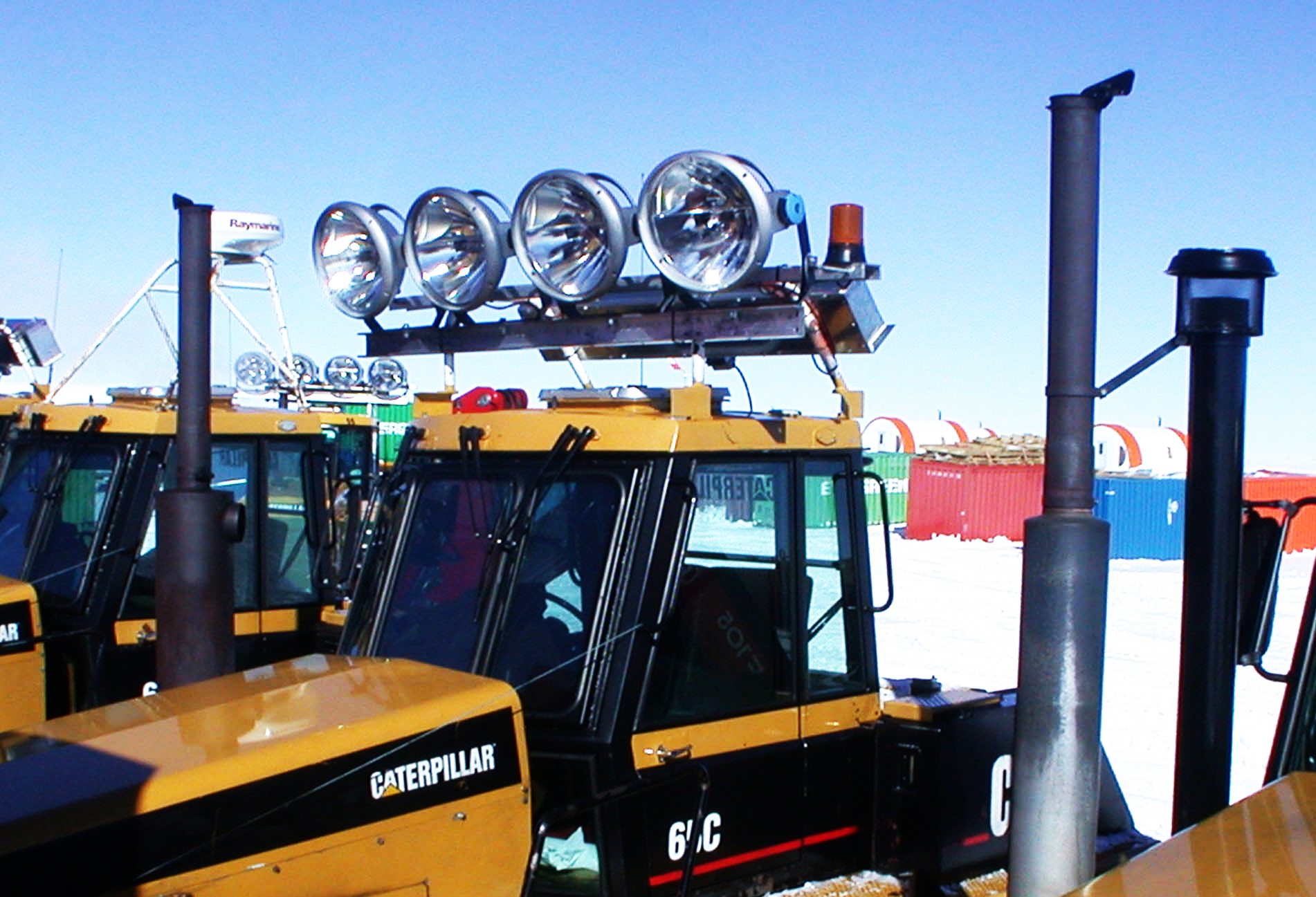
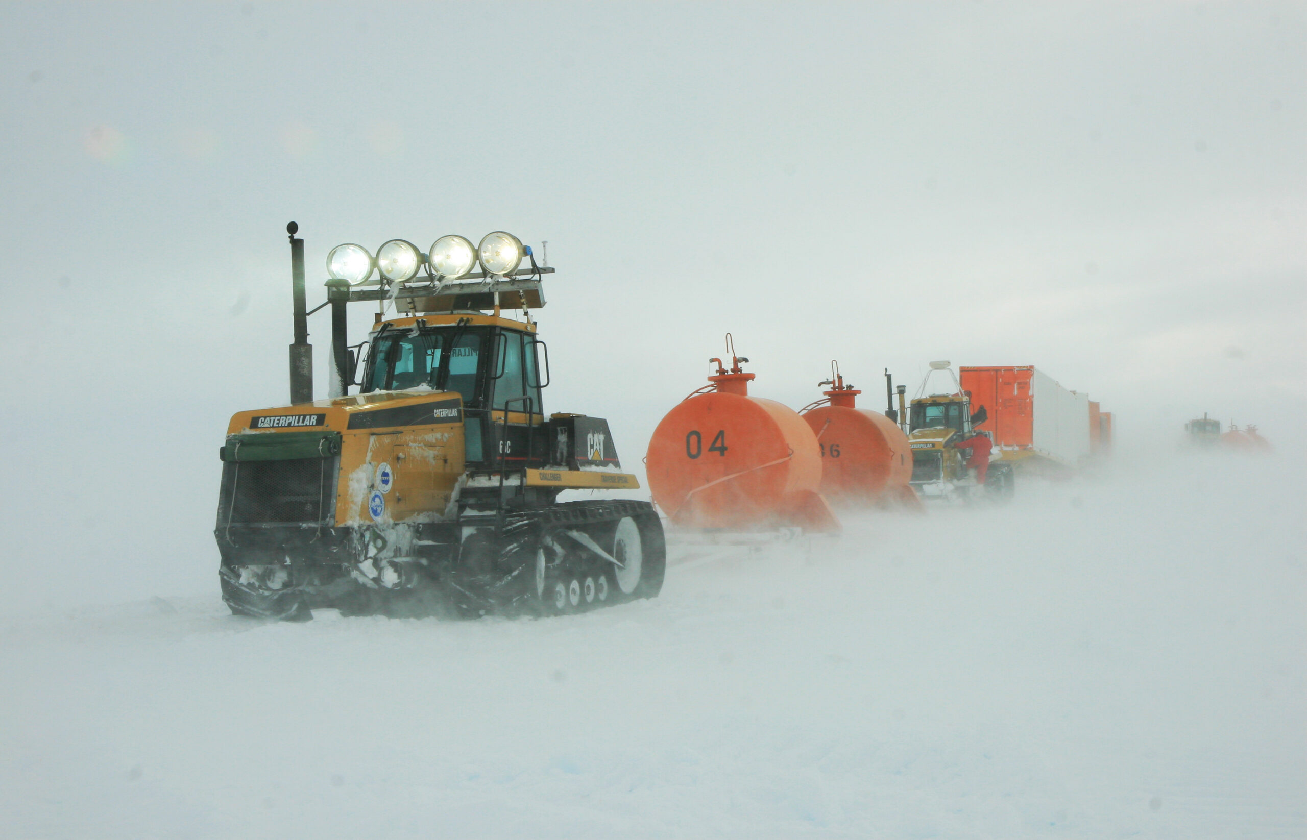
Without receivers capable of providing metre-level accuracy, the question of staying on the compacted — and load-bearing — track remained unresolved, and white-out conditions continued to pose a real problem. Considering that the underlying challenge was always one of improving discrimination, optical solutions were revisited. Many approaches were studied; the one adopted uses high-powered floodlights (2,000 W × 4) producing 220,000 lumens — exceeding sunlight at 120,000 lumens — making it possible to distinguish the ground surface under white-out conditions by recreating shadows. The effectiveness of the floodlights is further enhanced by filtering goggles that block UV and blue light (which is diffuse), favouring the floodlight’s own spectral output.
lit by floodlights
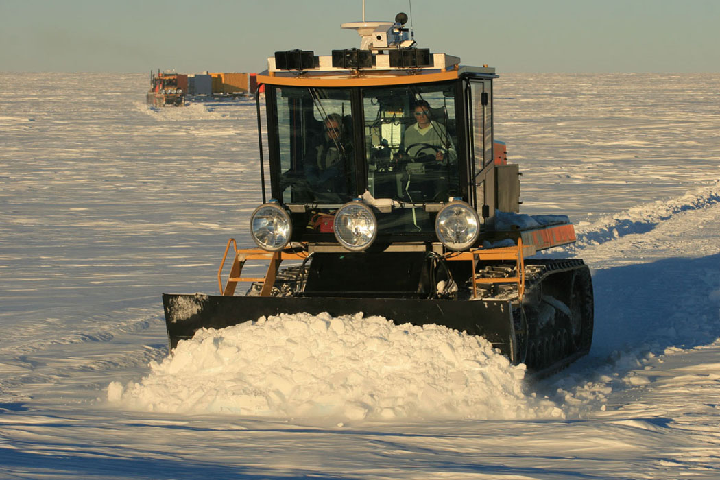
based on a Challenger C65 chassis
Today the system is mature and effective. In summary:
• The physical route is continuously marked by the berm.
• Its location in bad weather is made easier by the floodlights, which render the berm’s relief visible under white-out conditions.
• Navigation receivers have improved significantly: the current receiver can acquire up to 80 satellites, processes three constellations (Navstar, Glonass, Galileo), and provides heading data.
• Navigation software is used, enabling the operator to determine position, follow a pre-plotted route, record the actual track followed, and subsequently follow a previously recorded track.
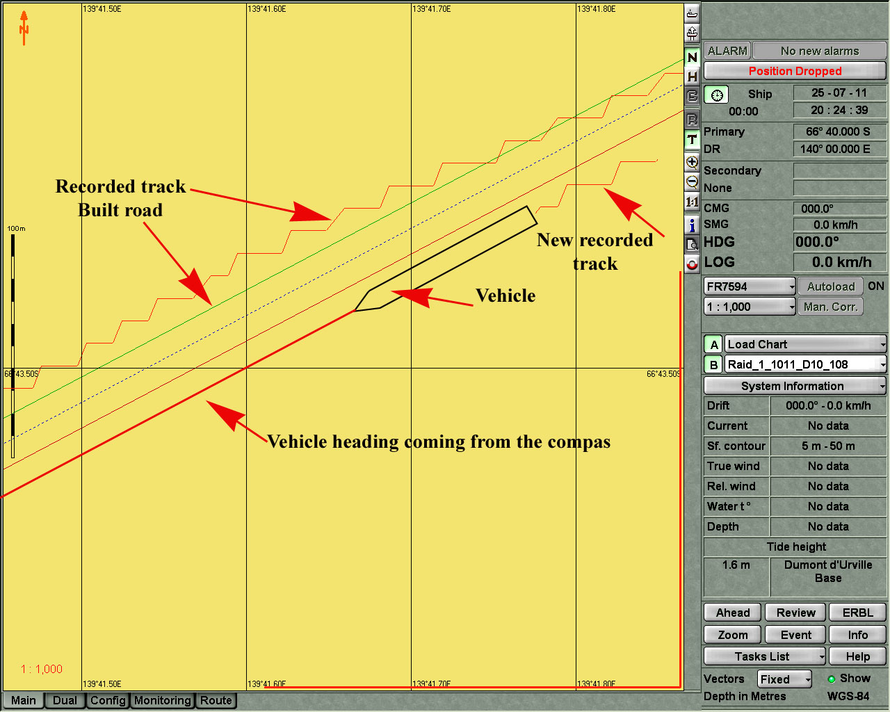
The accuracy provided by the system is in the order of 1.5 m. Although the threshold of what constitutes prohibitive weather has been substantially pushed back, this remains insufficient for travelling under load when visibility drops below 10 m.
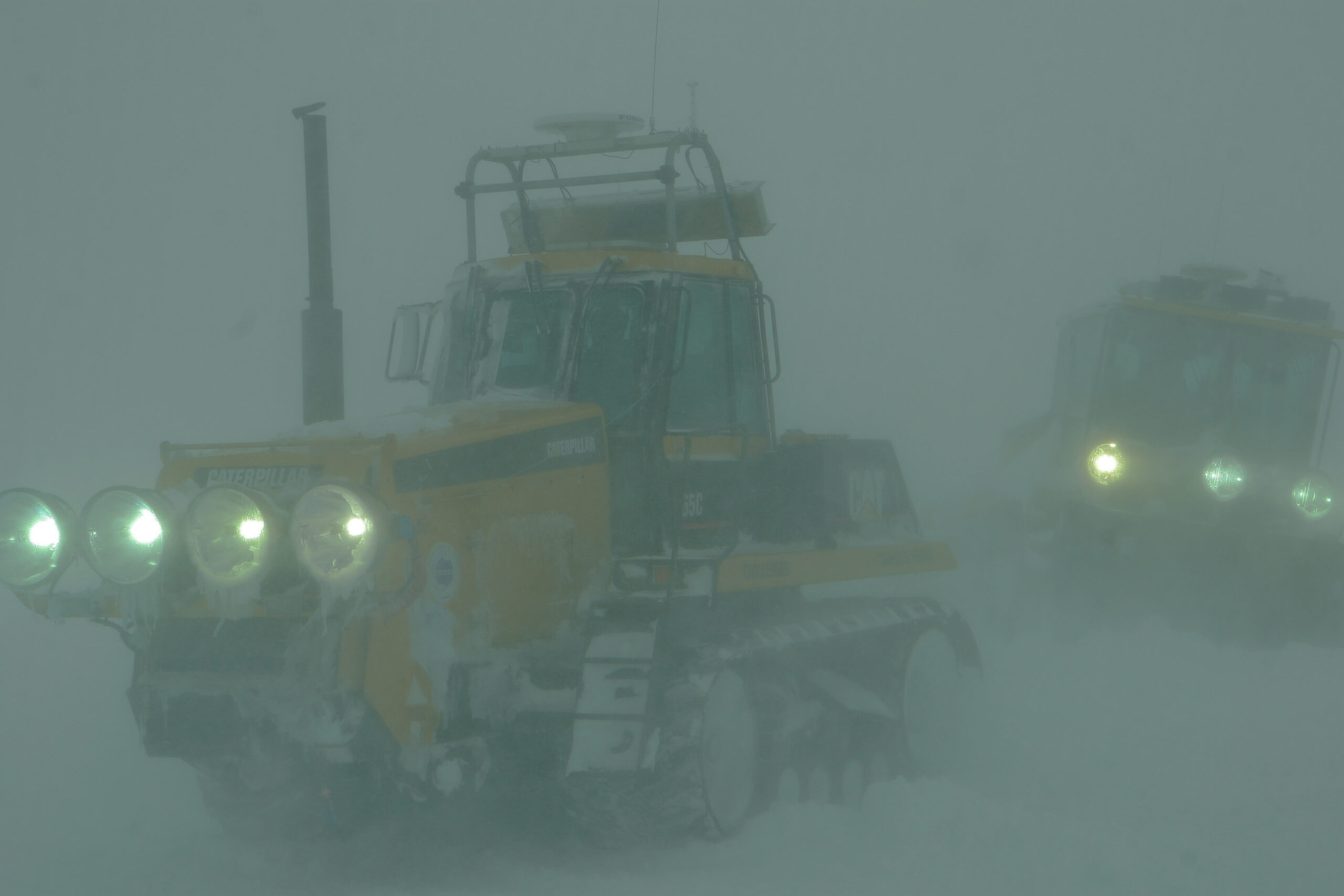
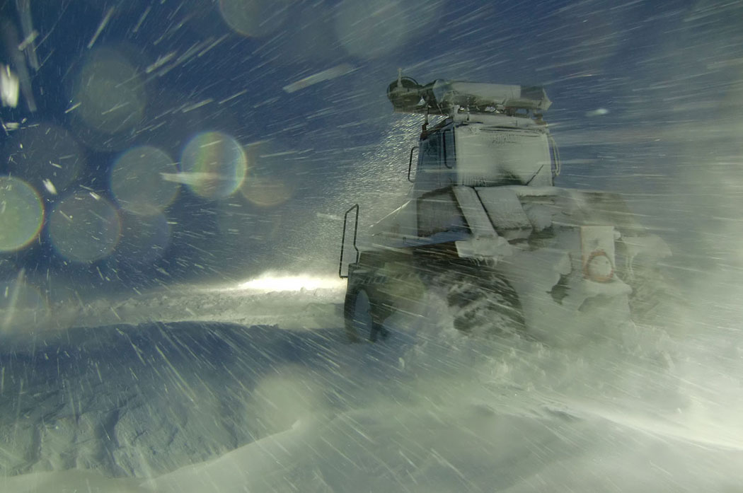
in bad weather using headlights